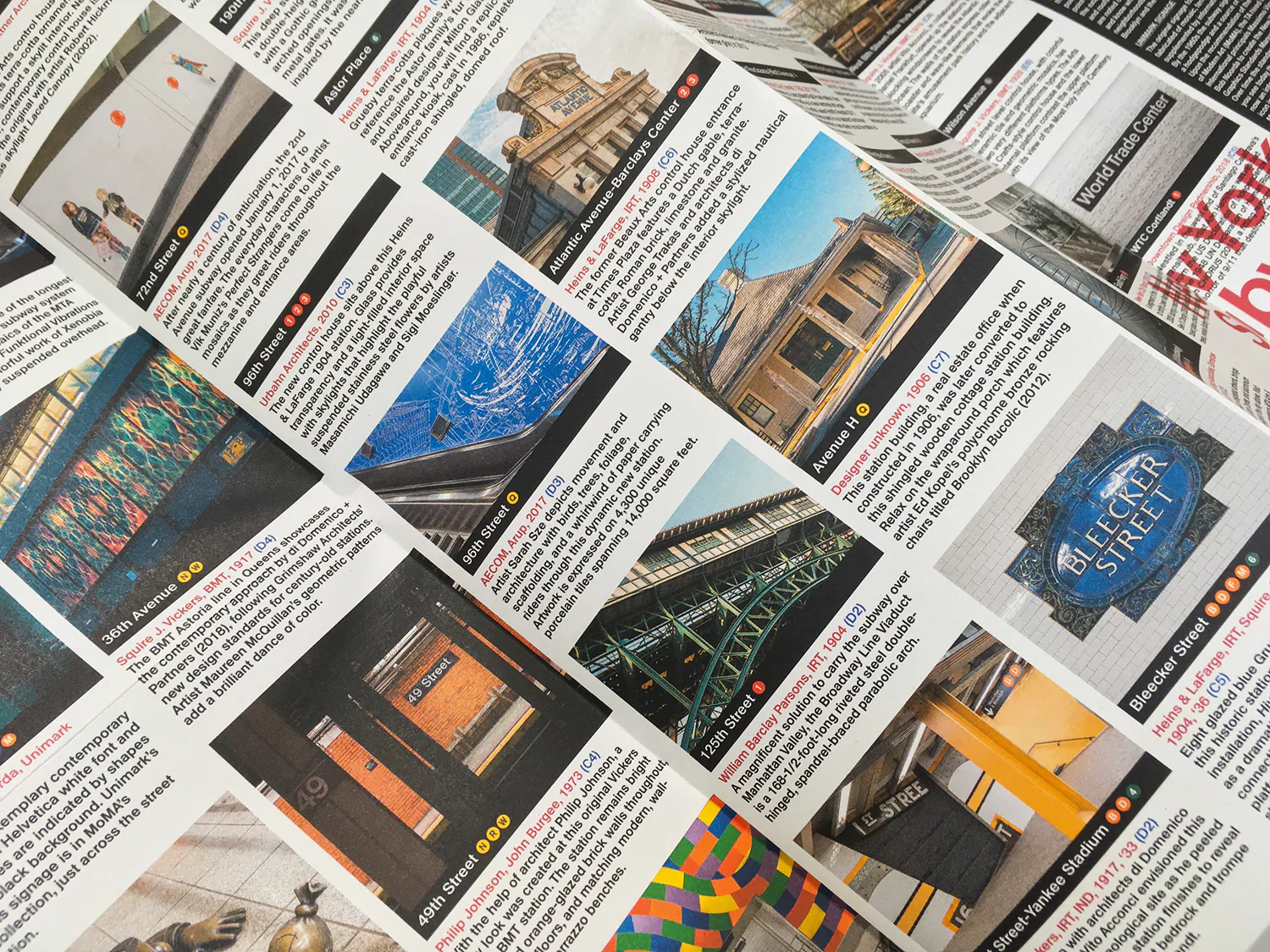
The Story
Curated by Sandra Bloodworth, Director of MTA Arts & Design, and Linda Tonn, Chief Architect of MTA New York City Transit, with original photography by Jason Woods, this two-sided cartographic guide is an insightful and fascinating guide to the Subway's architecture, art and graphic design for transport lovers, students of design and anyone interested in the history of New York City.
The guide includes a geographical Subway map with featured stations marked, with corresponding photography and details on the reverse along with tips for where to find unique and unusual signage, murals, artworks and more.
The map opens to 420 x 594 mm (16.5 x 23.4 in) and folds to (148 x 210 mm 5.8 x 8.3 in). It is protected by a Kraft slipcover.
Details & Craftsmanship
Every detail has been carefully considered to bring you the perfect product.

Details & Craftsmanship
Every detail has been carefully considered to bring you the perfect product.

Details & Craftsmanship
Every detail has been carefully considered to bring you the perfect product.
Description
Curated by Sandra Bloodworth, Director of MTA Arts & Design, and Linda Tonn, Chief Architect of MTA New York City Transit, with original photography by Jason Woods, this two-sided cartographic guide is an insightful and fascinating guide to the Subway's architecture, art and graphic design for transport lovers, students of design and anyone interested in the history of New York City.
The guide includes a geographical Subway map with featured stations marked, with corresponding photography and details on the reverse along with tips for where to find unique and unusual signage, murals, artworks and more.
The map opens to 420 x 594 mm (16.5 x 23.4 in) and folds to (148 x 210 mm 5.8 x 8.3 in). It is protected by a Kraft slipcover.